Окрестности Ташанты / geographic pointLandscapes and habitats
online plant identification guide
Directories
Region
| Geographic point: | Окрестности Ташанты |
| Coordinates: | 49° 42′ 06″ N, 89° 06′ 53″ E (view at maps of Google, OpenStreetMap, Yandex) |
| Administrative location: | Россия, Республика Алтай, Кош-Агачский район, окрестности села Ташанта |
| Physiographic location: | Горы Южной Сибири, Алтай, Юго-Восточный Алтай, Чуйская котловина |
| Author: | Alexander Fateryga |
Images
From 1 to 3 are shown (3 of 3 found)
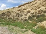 |
 Окрестности Ташанты Крутой обрыв к ручью с доминированием Artemisia santolinifolia. 27 июня 2022 г. summer |
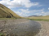 |
Окрестности Ташанты Каменистое русло ручья. 27 июня 2022 г. summer |
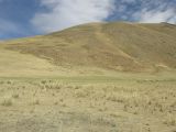 |
Окрестности Ташанты Выбитая перевыпасом степь; среди травы выделяются сухие стебли Neotrinia splendens. 27 июня 2022 г. summer |
Plants and lichens
Participant
Search
| Feedback | Text to cite the page | To the top |