Хребет Жетыжол / geographic pointLandscapes and habitats
online plant identification guide
Directories
Region
| Geographic point: | Хребет Жетыжол |
| Coordinates: | 43° 10′ 38.79″ N, 75° 21′ 52.59″ E (view at maps of Google, OpenStreetMap, Yandex) |
| Administrative location: | Казахстан, Алматинская область, Жамбылский район |
| Physiographic location: | Средняя Азия и Центральный Казахстан, Горы Средней Азии и Казахстана, Тянь-Шань, Северный Тянь-Шань, Заилийский Алатау, хребет Жетыжол |
| Author: | Игорь Стяжкин |
Description
Хребет Жетыжол (Жетижол) — небольшая горная гряда на западе Заилийского Алатау, между горами Кендыктас и Каракастекским хребтом. Длина около 70 км, максимальная высота — гора Суыктобе — 3273 м.
Images
From 1 to 4 are shown (4 of 4 found)
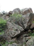 |
 Хребет Жетыжол Цветущие в скалах растения - Tulipa ostrowskiana и Spiraea hypericifolia. late spring or early summer |
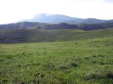 |
Хребет Жетыжол Пейзажи высокогорья. late spring or early summer |
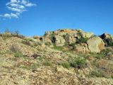 |
Хребет Жетыжол Пейзажи высокогорья. late spring or early summer |
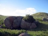 |
Хребет Жетыжол Пейзаж высокогорья. Растение на камне - Ephedra. late spring or early summer |
Text to cite the page
Стяжкин И. 2011—2022. Хребет Жетыжол [географическая точка: ландшафты и сообщества] // Плантариум. Растения и лишайники России и сопредельных стран: открытый онлайн атлас и определитель растений. [Электронный ресурс] URL: https://www.plantarium.ru/page/landscapes/point/891.html (дата обращения: 04.10.2026).
Стяжкин И. 2011—2022. Хребет Жетыжол [geographic point: photos of landscapes and habitats] // Plantarium. Plants and lichens of Russia and neighboring countries: open online galleries and plant identification guide. URL: https://www.plantarium.ru/lang/en/page/landscapes/point/891.html (accessed on 4 Oct 2026).
Plants and lichens
Participant
Search
|
|
Feedback | To the top |