Село Наваты / geographic pointLandscapes and habitats
online plant identification guide
Directories
Region
| Geographic point: | Село Наваты |
| Coordinates: | 55° 29′ 29.41″ N, 46° 16′ 25.84″ E (view at maps of Google, OpenStreetMap, Yandex) |
| Administrative location: | Россия, Нижегородская область, Пильненский район, Языковский сельсовет, село Наваты |
| Physiographic location: | Восточно-Европейская равнина, бассейн реки Волга, бассейн реки Сура, долина реки Сура • Восточно-Европейская равнина, Приволжская возвышенность, возвышенность Межпьянье |
| Author: | Sergey Appolonov |
Description
Растения в окрестностях с. Наваты, на правом берегу р. Сура. В район включены озёро Малый Нават и озеро Холодное.
Images
From 1 to 2 are shown (2 of 2 found)
 |
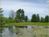
Село Наваты Озеро Малый Нават. 25 июня 2009 г. summer |
 |
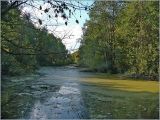
Село Наваты Озеро Холодное. 25 сентября 2008 г. autumn |
Text to cite the page
Апполонов С.М. 2010—2020. Село Наваты [географическая точка: ландшафты и сообщества] // Плантариум. Растения и лишайники России и сопредельных стран: открытый онлайн атлас и определитель растений. [Электронный ресурс] URL: https://www.plantarium.ru/page/landscapes/point/72.html (дата обращения: 19.01.2026).
Appolonov S. 2010—2020. Село Наваты [geographic point: photos of landscapes and habitats] // Plantarium. Plants and lichens of Russia and neighboring countries: open online galleries and plant identification guide. URL: https://www.plantarium.ru/lang/en/page/landscapes/point/72.html (accessed on 19 Jan 2026).
Plants and lichens
Participant
Search
|
|
Feedback | To the top |