Боткинская тропа / geographic pointLandscapes and habitats
online plant identification guide
Directories
Region
| Geographic point: | Боткинская тропа |
| Coordinates: | 44° 29′ 55″ N, 34° 05′ 58″ E (view at maps of Google, OpenStreetMap, Yandex) |
| Administrative location: | Россия, Республика Крым, городской округ Ялта, Ялтинский горно-лесной природный заповедник |
| Physiographic location: | Средиземноморье и Переднеазиатские нагорья, Горный Крым, Главная гряда, Ай-Петринская яйла |
| Author: | Yuliya Borisova |
Description
Начало тропы — от "Поляны Сказок" через пересыхающий ручей Ай-Даниль к водопадам Нижнему и Верхнему Яузларам и реке Яузлар (Явлуз) — левому притоку реки Учан-Су, далее к скале Ставри-Кая. Продолжение тропы от Ставри-Кая к водопаду Учан-Су называется Штангеевской тропой, но в литературе их часто объединяют. 44°29'55"N 34°5'58"E — координаты Ставри-Кая, конечной точки.
Images
The author of the photos shown here is Alexander Fateryga. These photos are just a part of the complete set of images.
From 1 to 6 are shown (6 of 6 found)
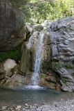 |
 Боткинская тропа Водопад на р. Яузлар; сверху нависает ветвь Frangula alnus, а в трещинах скал видны Adiantum capillus-veneris и Eupatorium cannabinum. 18 июля 2023 г. summer |
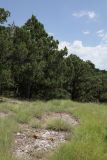 |
Боткинская тропа Поляна, заросшая Bothriochloa ischaemum среди леса из Juniperus excelsa. 18 июля 2023 г. summer |
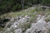 |
Боткинская тропа Выходы известняка с Elytrigia nodosa, Bothriochloa ischaemum и цветущим Teucrium chamaedrys среди леса из Juniperus excelsa. 18 июля 2023 г. summer |
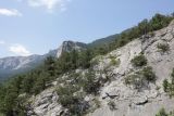 |
Боткинская тропа Редколесье из Juniperus excelsa на скалах и вид на скалу Ставри-Кая. 18 июля 2023 г. summer |
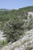 |
Боткинская тропа Редколесье из Juniperus excelsa на каменистом склоне; среди низкорослых кустарников заметен Jasminum fruticans. 18 июля 2023 г. summer |
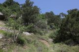 |
Боткинская тропа Фрагмент леса из Juniperus excelsa с кустарниками Cistus tauricus, а также Quercus pubescens, Carpinus betulus и Jasminum fruticans. 18 июля 2023 г. summer |
Plants and lichens
Participant
Search
|
|
Feedback | Text to cite the page | To the top |