Valle de Bujaruelo / geographic pointLandscapes and habitats
online plant identification guide
Directories
Region
| Geographic point: | Valle de Bujaruelo |
| Coordinates: | 42° 40′ 39.39″ N, 0° 07′ 24.13″ W (view at maps of Google, OpenStreetMap, Yandex) |
| Administrative location: | Испания, автономное сообщество Арагон, провинция Уэска, комарка Собрарбе, муниципалитет Торла |
| Physiographic location: | Средиземноморье и Переднеазиатские нагорья, Пиренейский полуостров, Пиренеи, долина Бухаруэло |
| Author: | Надежда Замкова |
Images
From 1 to 4 are shown (4 of 4 found)
 |
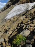
Valle de Bujaruelo Снежник над перевалом Бухаруэло. late summer — early autumn |
 |
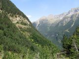
Valle de Bujaruelo Дорога на перевал Бухаруэло. late summer — early autumn |
Text to cite the page
Замкова Н. 2012. Valle de Bujaruelo [географическая точка: ландшафты и сообщества] // Плантариум. Растения и лишайники России и сопредельных стран: открытый онлайн атлас и определитель растений. [Электронный ресурс] URL: https://www.plantarium.ru/page/landscapes/point/1849.html (дата обращения: 10.02.2026).
Замкова Н. 2012. Valle de Bujaruelo [geographic point: photos of landscapes and habitats] // Plantarium. Plants and lichens of Russia and neighboring countries: open online galleries and plant identification guide. URL: https://www.plantarium.ru/lang/en/page/landscapes/point/1849.html (accessed on 10 Feb 2026).
Plants and lichens
Participant
Search
|
|
Feedback | To the top |

