Бесарык / geographic pointLandscapes and habitats
online plant identification guide
Directories
Region
| Geographic point: | Бесарык |
| Coordinates: | 43° 56′ 26.16″ N, 67° 59′ 59″ E (view at maps of Google, OpenStreetMap, Yandex) |
| Administrative location: | Казахстан, Кызылординская область, Жанакорганский район, окрестности селения Талдысу • Казахстан, Туркестанская область, Сауранский район, окрестности селения Талдысу |
| Physiographic location: | Средняя Азия и Центральный Казахстан, Горы Средней Азии и Казахстана, хребет Сырдарьинский Каратау, Центральный Каратау, река Бесарык |
| Author: | Yuri Pirogov |
Description
Долина реки Бесарык
Images
From 1 to 9 are shown (9 of 9 found)
 |
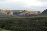
Бесарык Каратавская куэста, вид на северо-восток. В центре - сухое русло реки Бесарык (река уходит здесь под землю), на горизонте - главный хребет Каратау. 29.04.2011. spring |
 |
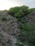
Бесарык Ущелье ручья, притока р. Бесарык. Вид на юг, на каратавскую куэсту. 29.04.2011. spring |
 |
Бесарык Ущелье ручья, притока р. Бесарык. 29.04.2011. spring |
 |
Бесарык Стойбище. 29.04.2011. spring |
 |
Бесарык Река Бесарык и поля местных жителей. 29.04.2011. spring |
 |
Бесарык Ущелье с родником и ивами. 28.04.2011. spring |
 |
Бесарык Долина р. Бесарык. Слева ивы у родника. 28.05.2011. spring |
 |
Бесарык Долина и ущелье р. Бесарык. 28.04.2011. spring |
 |
Бесарык Вид на долину р. Бесарык в каратавской куэсте. 28.04.2011. spring |
Text to cite the page
Пирогов Ю.К. 2011—2018. Бесарык [географическая точка: ландшафты и сообщества] // Плантариум. Растения и лишайники России и сопредельных стран: открытый онлайн атлас и определитель растений. [Электронный ресурс] URL: https://www.plantarium.ru/page/landscapes/point/1378.html (дата обращения: 04.02.2026).
Pirogov Y. 2011—2018. Бесарык [geographic point: photos of landscapes and habitats] // Plantarium. Plants and lichens of Russia and neighboring countries: open online galleries and plant identification guide. URL: https://www.plantarium.ru/lang/en/page/landscapes/point/1378.html (accessed on 4 Feb 2026).
Plants and lichens
Participant
Search
|
|
Feedback | To the top |