Гора Казах / geographic pointLandscapes and habitats
online plant identification guide
Directories
Region
| Geographic point: | Гора Казах |
| Coordinates: | 44° 48′ 52.14″ N, 34° 42′ 47.16″ E (view at maps of Google, OpenStreetMap, Yandex) |
| Administrative location: | Россия, Республика Крым, городской округ Алушта, окрестности села Приветное |
| Physiographic location: | Средиземноморье и Переднеазиатские нагорья, Горный Крым, Южный берег Крыма, гора Казах |
| Author: | Tatiana Vinokurova |
Description
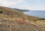
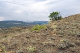
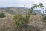
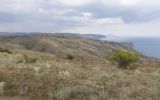
Гора Казах (262 м н.у.м.) расположена на юго-восточном побережье Крымского полуострова, её южные склоны выходят к Чёрному морю. Склоны каменистые, поросли степью (преобладают Artemisia spp., Helichrysum arenarium, Galatella villosa, злаки), кое-где растут единичные деревца Paliurus spina-christi, Crataegus и Pyrus elaeagrifolia, кусты шиповника.
Images
From 1 to 8 are shown (8 of 8 found)
 |
Гора Казах Плодоносящие Reseda lutea и Teucrium polium на мелкощебнистом субстрате. 24.07.2019. summer |
 |
Гора Казах Деревца и кусты Paliurus spina-christi, Crataegus orientalis, Pyrus elaeagrifolia и Rosa andegavensis среди полынно-степного сообщества. 24.07.2019. summer |
 |
Гора Казах Зацветающая Artemisia taurica в каменистой степи. 24.07.2019. summer |
Text to cite the page
Винокурова Т. 2019. Гора Казах [географическая точка: ландшафты и сообщества] // Плантариум. Растения и лишайники России и сопредельных стран: открытый онлайн атлас и определитель растений. [Электронный ресурс] URL: https://www.plantarium.ru/page/landscapes/point/10548.html (дата обращения: 30.01.2026).
Vinokurova T. 2019. Гора Казах [geographic point: photos of landscapes and habitats] // Plantarium. Plants and lichens of Russia and neighboring countries: open online galleries and plant identification guide. URL: https://www.plantarium.ru/lang/en/page/landscapes/point/10548.html (accessed on 30 Jan 2026).
Plants and lichens
Participant
Search
|
|
Feedback | To the top |


