Зарамагская котловина / geographic pointPhotos of plants and lichens
online plant identification guide
Directories
Region
| Geographic point: | Зарамагская котловина |
| Coordinates: | 42° 41′ 53″ N, 43° 57′ 32″ E (view at maps of Google, OpenStreetMap, Yandex) |
| Administrative location: | Россия, Республика Северная Осетия-Алания, Алагирский район |
| Physiographic location: | Кавказ, Большой Кавказ, долина реки Ардон, Зарамагская котловина |
| Author: | Igor Nikolaev |
| Description: | show |
Images
Single image is found
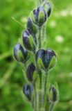 |
 Созревающие плоды. Северная Осетия, бассейн р. Ардон, Зарамагская котловина, ущелье Цмиаком, ≈ 1800 м н.у.м., луг. 12.06.2014. |
Plants and lichens
Participant
Search
| Feedback | Text to cite the page | To the top |