Озерко в окр. Куруша / geographic pointPhotos of plants and lichens
online plant identification guide
Directories
Region
| Geographic point: | Озерко в окр. Куруша |
| Coordinates: | 41° 16′ 11.88″ N, 47° 48′ 57.51″ E (view at maps of Google, OpenStreetMap, Yandex) |
| Administrative location: | Россия, Республика Дагестан, Докузпаринский район, окрестности села Куруш |
| Physiographic location: | Кавказ, Большой Кавказ, Восточный Кавказ, бассейн реки Самур, бассейн реки Усухчай, бассейн реки Чехычай, долина реки Чехычай |
| Author: | Tatiana Vinokurova |
| Description: | show |
Images
From 1 to 10 are shown (10 of 10 found)
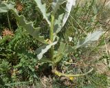 |
 Основание вегетирующего растения. Дагестан, Докузпаринский р-н, окр. с. Куруш, дол. р. Чехычай, ≈ 2500 м н.у.м., у небольшого озера в притоке р. Чехычай. 25.07.2026. |
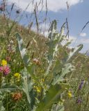 |
 Верхушка побега с развивающимся соцветием. Дагестан, Докузпаринский р-н, окр. с. Куруш, дол. р. Чехычай, ≈ 2500 м н.у.м., у небольшого озера в притоке р. Чехычай. 25.07.2026. |
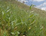 |
Верхушки вегетирующих растений. Дагестан, Докузпаринский р-н, окр. с. Куруш, дол. р. Чехычай, ≈ 2500 м н.у.м., у небольшого озера в притоке р. Чехычай. 25.07.2026. |
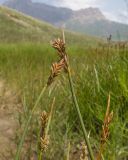 |
Верхушки побегов с отцветшими соцветиями. Дагестан, Докузпаринский р-н, окр. с. Куруш, дол. р. Чехычай, у небольшого озера в притоке р. Чехычай, на обсохшем дне. 25.07.2026. |
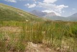 |
Цветущие растения. Дагестан, Докузпаринский р-н, окр. с. Куруш, дол. р. Чехычай, у небольшого озера в притоке р. Чехычай. 25.07.2026. |
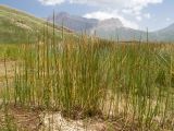 |
Цветущие растения. Дагестан, Докузпаринский р-н, окр. с. Куруш, дол. р. Чехычай, у небольшого озера в притоке р. Чехычай. 25.07.2026. |
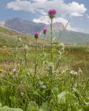 |
Цветущие растения. Дагестан, Докузпаринский р-н, окр. с. Куруш, дол. р. Чехычай, ≈ 2500 м н.у.м., у небольшого озера в притоке р. Чехычай. 25.07.2026. |
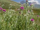 |
Верхушки растений с соцветиями. Дагестан, Докузпаринский р-н, окр. с. Куруш, дол. р. Чехычай, ≈ 2500 м н.у.м., у небольшого озера в притоке р. Чехычай. 25.07.2026. |
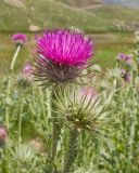 |
Раскрывшееся и бутонизирующее соцветия. Дагестан, Докузпаринский р-н, окр. с. Куруш, дол. р. Чехычай, ≈ 2500 м н.у.м., у небольшого озера в притоке р. Чехычай. 25.07.2026. |
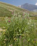 |
Цветущие растения. Дагестан, Докузпаринский р-н, окр. с. Куруш, дол. р. Чехычай, ≈ 2500 м н.у.м., у небольшого озера в притоке р. Чехычай. 25.07.2026. |
Text to cite the page
Винокурова Т. 2026. Озерко в окр. Куруша [географическая точка: фотографии растений и лишайников] // Плантариум. Растения и лишайники России и сопредельных стран: открытый онлайн атлас и определитель растений. [Электронный ресурс] URL: https://www.plantarium.ru/page/dwellers/point/13471.html (дата обращения: 08.10.2026).
Vinokurova T. 2026. Озерко в окр. Куруша [geographic point: photos of plants and lichens] // Plantarium. Plants and lichens of Russia and neighboring countries: open online galleries and plant identification guide. URL: https://www.plantarium.ru/lang/en/page/dwellers/point/13471.html (accessed on 8 Oct 2026).
Plants and lichens
Participant
Search
|
|
Feedback | To the top |