Окрестности посёлка Усть-Югуш / geographic pointLandscapes and habitats
online plant identification guide
Directories
Region
| Geographic point: | Окрестности посёлка Усть-Югуш |
| Coordinates: | 54° 24′ 40″ N, 58° 37′ 56″ E (view at maps of Google, OpenStreetMap, Yandex) |
| Administrative location: | Россия, Свердловская область, Артинский городской округ, окрестности посёлка Усть-Югуш |
| Physiographic location: | Урал, Южный Урал, долина реки Уфа |
| Author: | Мария Жукова |
Images
From 1 to 3 are shown (3 of 3 found)
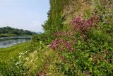 |
 Окрестности посёлка Усть-Югуш Небольшое прибрежное растительное сообщество - душица (Origanum), костяника (Rubus saxatilis) и (?). 24 июля 2016 г. summer |
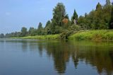 |
Окрестности посёлка Усть-Югуш Долина р. Уфа выше пос. Усть-Югуш. 24 июля 2016 г. summer |
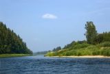 |
Окрестности посёлка Усть-Югуш Долина р. Уфа выше пос. Усть-Югуш. 24 июля 2016 г. summer |
Plants and lichens
Participant
Search
| Feedback | Text to cite the page | To the top |