Солза / geographic pointLandscapes and habitats
online plant identification guide
Directories
Region
| Geographic point: | Солза |
| Coordinates: | 64° 33′ 54″ N, 39° 29′ 15″ E (view at maps of Google, OpenStreetMap, Yandex) |
| Administrative location: | Россия, Архангельская область, Приморский район, деревня Солза |
| Physiographic location: | Восточно-Европейская равнина, Онежский полуостров |
| Author: | Gennadiy Okatov |
Images
From 1 to 4 are shown (4 of 4 found)
 |
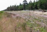
Солза Аспект цветущей Dianthus superbus на побережье Белого моря. 08.07.2013. summer |
 |
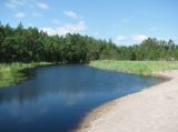
Солза Ручей Бритнев близ впадения в Белое море. Справа на берегу аспект Phragmites australis. 08.07.2013. summer |
 |
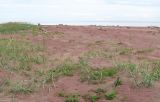
Солза Приморский песок на побережье Белого моря. Видны Leymus arenarius, Lathyrus maritimus, Honckenya peploides s.l. 05.07.2014. summer |
 |
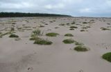
Солза Приморские пески в пасмурный день. Видны "кочки" Honckenya peploides s.l., а также отдельные группировки Leymus arenarius. 17.08.2013. summer |
Text to cite the page
Окатов Г. 2013—2019. Солза [географическая точка: ландшафты и сообщества] // Плантариум. Растения и лишайники России и сопредельных стран: открытый онлайн атлас и определитель растений. [Электронный ресурс] URL: https://www.plantarium.ru/page/landscapes/point/2340.html (дата обращения: 10.02.2026).
Okatov G. 2013—2019. Солза [geographic point: photos of landscapes and habitats] // Plantarium. Plants and lichens of Russia and neighboring countries: open online galleries and plant identification guide. URL: https://www.plantarium.ru/lang/en/page/landscapes/point/2340.html (accessed on 10 Feb 2026).
Plants and lichens
Participant
Search
|
|
Feedback | To the top |