Ущелье реки Даут / geographic pointLandscapes and habitats
online plant identification guide
Directories
Region
| Geographic point: | Ущелье реки Даут |
| Coordinates: | 43° 24′ 25″ N, 41° 53′ 50″ E (view at maps of Google, OpenStreetMap, Yandex) |
| Administrative location: | Россия, Карачаево-Черкесская Республика, Карачаевский район |
| Physiographic location: | Кавказ, Большой Кавказ, бассейн реки Кубань, бассейн реки Уллу-Кам, ущелье реки Даут;Кавказ, Большой Кавказ, Даутский хребет;Кавказ, Большой Кавказ, Кышхаджерский хребет |
| Author: | Vladimir Inozemtsew |
Images
From 1 to 6 are shown (6 of 6 found)
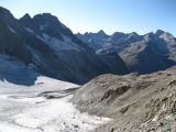 |
 Ущелье реки Даут Скалы, осыпи и язык Даутского ледника. На заднем плане вершины Кышхаджерского хребта. Снимок сделан с Даутского хребта (перевал Саламандра). 30.08.2011. late summer or early autumn |
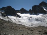 |
Ущелье реки Даут Даутский ледник. late summer or early autumn |
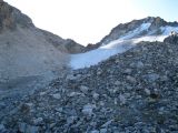 |
Ущелье реки Даут Ледник и осыпь с субнивальной растительностью перед началом подъёма к перевалу Нефтяник в хребте Даут. late summer or early autumn |
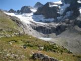 |
Ущелье реки Даут Участок хребта Даут с альпийской растительностью в районе Даутского ледника. late summer or early autumn |
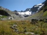 |
Ущелье реки Даут Поляна с субальпийской растительностью перед истоком реки Даут. late summer or early autumn |
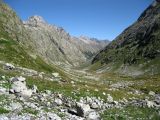 |
Ущелье реки Даут Альпийская растительность на склонах хребтов в ущелье Даут; впереди - последний участок леса. late summer or early autumn |
Text to cite the page
Иноземцев В.И. 2013. Ущелье реки Даут [географическая точка: ландшафты и сообщества] // Плантариум. Растения и лишайники России и сопредельных стран: открытый онлайн атлас и определитель растений. [Электронный ресурс] URL: https://www.plantarium.ru/page/landscapes/point/2171.html (дата обращения: 15.09.2026).
Inozemtsew V. 2013. Ущелье реки Даут [geographic point: photos of landscapes and habitats] // Plantarium. Plants and lichens of Russia and neighboring countries: open online galleries and plant identification guide. URL: https://www.plantarium.ru/lang/en/page/landscapes/point/2171.html (accessed on 15 Sep 2026).
Plants and lichens
Participant
Search
|
|
Feedback | To the top |