Северный исток реки Алибек / geographic pointLandscapes and habitats
online plant identification guide
Directories
Region
| Geographic point: | Северный исток реки Алибек |
| Coordinates: | 43° 19′ 38″ N, 41° 32′ 56″ E (view at maps of Google, OpenStreetMap, Yandex) |
| Administrative location: | Россия, Карачаево-Черкесская Республика, Карачаевский район, окрестности поселка Домбай |
| Physiographic location: | Кавказ, Большой Кавказ, бассейн реки Теберда, долина реки Алибек |
| Author: | Vladimir Inozemtsew |
Description
На пути следования от альплагеря Алибек к перевалам Алибек и Сулахат.
Images
Single image is found
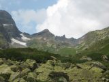 |
  Северный исток реки Алибек Заросли можжевельника и рододендронов на пути к перевалу Алибек. late summer or early autumn |
Plants and lichens
Participant
Search
| Feedback | Text to cite the page | To the top |