Бугры / geographic pointLandscapes and habitats
online plant identification guide
Directories
Region
| Geographic point: | Бугры |
| Coordinates: | 47° 43′ 40″ N, 40° 03′ 50″ E (view at maps of Google, OpenStreetMap, Yandex) |
| Administrative location: | Россия, Ростовская область, Аксайский район |
| Physiographic location: | Восточно-Европейская равнина, Донецкий кряж |
| Author: | Vladimir Inozemtsew |
Description
Небольшой участок на правом высоком берегу р. Тузлов на границе Аксайского района и г. Новочеркасска. На участке преобладает разнотравно-типчаково-ковыльный тип приазовских степей, его пересекают балки, к нему примыкает пустырь.
Images
From 1 to 3 are shown (3 of 3 found)
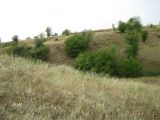 |
 Бугры Степь с аспектом цветущей Scabiosa ucranica на склоне балки. На дальнем склоне - Ulmus pumila. late summer or early autumn |
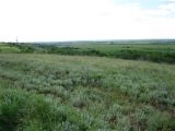 |
Бугры Степь с цветущим Salvia nutans на правом высоком берегу р. Тузлов. summer |
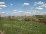 |
Бугры Степная балка, зарастающая по склонам и днищу деревьями и кустарниками. spring |
Plants and lichens
Participant
Search
|
|
Feedback | Text to cite the page | To the top |