Долина реки Рогатки / geographic pointLandscapes and habitats
online plant identification guide
Directories
Region
| Geographic point: | Долина реки Рогатки |
| Coordinates: | 46° 58′ 23″ N, 142° 49′ 41″ E (view at maps of Google, OpenStreetMap, Yandex) |
| Administrative location: | Россия, Сахалинская область, город Южно-Сахалинск |
| Physiographic location: | Дальний Восток, Юг Дальнего Востока, остров Сахалин, Сусунайский хребет, долина реки Рогатка |
| Author: | Кирилл Корзников |
Images
Single image is found
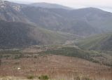 |
 Долина реки Рогатки Сообщества горных склонов долины р. Рогатка. Каменноберезовые леса (Betula ermanii) - коричневые, культуры лиственницы (Larix cajanderi) - светло-зеленые, елово-пихтовый древостой - темно-зелёный. 22.05.2012. late spring or early summer |
Plants and lichens
Participant
Search
| Feedback | Text to cite the page | To the top |