Pamir / geographic pointLandscapes and habitats
online plant identification guide
Directories
Region
| Geographic point: | Pamir |
| Coordinates: | 37° 15′ 36.2″ N, 72° 54′ 51.5″ E (view at maps of Google, OpenStreetMap, Yandex) |
| Administrative location: | Таджикистан, Горно-Бадахшанская автономная область, Ишкашимский район |
| Physiographic location: | Средняя Азия и Центральный Казахстан, Горы Средней Азии и Казахстана, бассейн реки Амударья, бассейн реки Пяндж, бассейн реки Памир;Средняя Азия и Центральный Казахстан, Горы Средней Азии и Казахстана, Памиро-Алай, Памир, Шахдаринский хребет |
| Author: | Vladimir Pankratov |
Description
Долина реки Памир представляет собой сухую высокогорную пустыню на высоте 3400-3800 м. На каменистых склонах преобладают Acantholimon, Astragalus, Hedysarum, Cousinia, Eremurus. В пойме реки редкие деревья Salix и Hippophae rhamnoides. Значительные площади поймы занимают солончаки и болотистые кочковатые луга.
Images
The author of the photos shown here is Alexander Fateryga. These photos are just a part of the complete set of images.
Single image is found
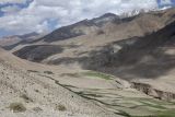 |
 Памир Вид на долину реки; на переднем плане Krascheninnikovia ceratoides. 4 июля 2026 г. summer |
Text to cite the page
Панкратов В., Фатерыга А. 2024—2026. Памир [географическая точка: ландшафты и сообщества] // Плантариум. Растения и лишайники России и сопредельных стран: открытый онлайн атлас и определитель растений. [Электронный ресурс] URL: https://www.plantarium.ru/page/landscapes/point/12697.html (дата обращения: 03.10.2026).
Pankratov V., Fateryga A. 2024—2026. Pamir [geographic point: photos of landscapes and habitats] // Plantarium. Plants and lichens of Russia and neighboring countries: open online galleries and plant identification guide. URL: https://www.plantarium.ru/lang/en/page/landscapes/point/12697.html (accessed on 3 Oct 2026).
Plants and lichens
Participant
Search
|
|
Feedback | To the top |