Игарка / geographic pointLandscapes and habitats
online plant identification guide
Directories
Region
| Geographic point: | Игарка |
| Coordinates: | 67° 27′ 29.91″ N, 86° 33′ 14.65″ E (view at maps of Google, OpenStreetMap, Yandex) |
| Administrative location: | Россия, Красноярский край, Туруханский район, город Игарка |
| Physiographic location: | Средняя Сибирь, бассейн реки Енисей, долина реки Енисей |
| Author: | Марина Скотникова |
Images
Single image is found
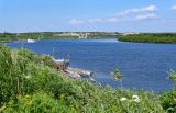 |
 Игарка Вид на Игарскую протоку и окраину г. Игарка с высокого правого берега р. Енисей. У воды растут Salix, Tanacetum, Heracleum. 21.07.2023. summer |
Plants and lichens
Participant
Search
| Feedback | Text to cite the page | To the top |