Саккара / geographic pointLandscapes and habitats
online plant identification guide
Directories
Region
| Geographic point: | Саккара |
| Coordinates: | 29° 51′ 23.47″ N, 31° 12′ 55.91″ E (view at maps of Google, OpenStreetMap, Yandex) |
| Administrative location: | Египет, мухафаза Эль-Гиза, окрестности города Саккара |
| Physiographic location: | Африка, Северная Африка, Сахара, бассейн реки Нил, долина реки Нил |
| Author: | Марина Скотникова |
Images
From 1 to 5 are shown (5 of 5 found)
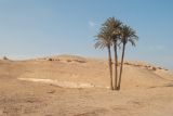 |
 Саккара Финиковые пальмы (Phoenix dactylifera) в каменисто-песчаной пустыне вблизи храмового комплекса в Саккаре. 03.01.2024. spring |
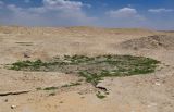 |
Саккара Участок каменисто-песчаной пустыни с Tetraena simplex и Rumex в окр. г. Саккара. 29.04.2023. late spring or early summer |
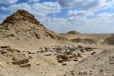 |
Саккара Каменисто-песчаная пустыня в окр. г. Саккара. 29.04.2023. late spring or early summer |
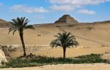 |
Саккара Каменисто-песчаная пустыня в окр. г. Саккара с Phoenix dactylifera и Imperata cylindrica у ручья. 29.04.2023. late spring or early summer |
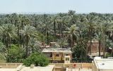 |
Саккара Посадки Phoenix dactylifera на западной окраине г. Саккара. 29.04.2023. late spring or early summer |
Plants and lichens
Participant
Search
| Feedback | Text to cite the page | To the top |