Вади Аль-Асид / geographic pointLandscapes and habitats
online plant identification guide
Directories
Region
| Geographic point: | Вади Аль-Асид |
| Coordinates: | 15° 03′ 33.05″ N, 48° 20′ 29.63″ E (view at maps of Google, OpenStreetMap, Yandex) |
| Administrative location: | Йемен, мухафаза Хадрамаут, национальный парк "Вади Аль-Асид" |
| Physiographic location: | Юго-Западная Азия, Аравийский полуостров, плато Аль-Джаул |
| Author: | Вадим Должанский |
Description
Пустыня на высоте 1300 метров над уровнем моря, разрезанная ущельями (вадами)
Images
From 1 to 5 are shown (5 of 5 found)
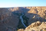 |
 Вади Аль-Асид В вадах, в местах где есть вода расположены древние городки-крепости. 21.03.2009. spring |
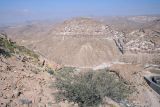 |
Вади Аль-Асид Плато разрезано глубокими вадами. 20.03.2009. spring |
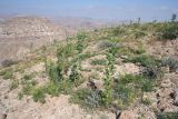 |
Вади Аль-Асид Изредка встречается весенняя зелень. 20.03.2009. spring |
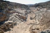 |
Вади Аль-Асид Сухой сай на плато. 20.03.2009. spring |
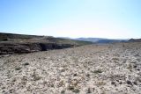 |
Вади Аль-Асид Плато на высоте 1200 метров над уровнем моря. 20.03.2009. spring |
Plants and lichens
Participant
Search
|
|
Feedback | Text to cite the page | To the top |