Сагарматха / geographic pointLandscapes and habitats
online plant identification guide
Directories
Region
| Geographic point: | Сагарматха |
| Coordinates: | 27° 55′ 12.42″ N, 86° 48′ 13.41″ E (view at maps of Google, OpenStreetMap, Yandex) |
| Administrative location: | Непал, 1-я провинция, район Солукхумбу, национальный парк "Сагарматха" |
| Physiographic location: | Южная и Юго-Восточная Азия, Гималаи, Большие Гималаи |
| Author: | Вадим Должанский |
Description
Горные хвойные и рододендровые леса
Images
From 1 to 5 are shown (5 of 5 found)
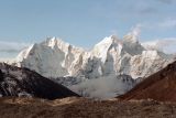 |
 Сагарматха Gorak Shep, вид на вершины Чимбу и Пумори. 07.05.1997. wet season |
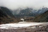 |
Сагарматха Снежники в районе поселка Dughla. 05.05.1997. wet season |
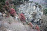 |
Сагарматха Цветущие кусты рододендронов на склонах. 04.05.1997. wet season |
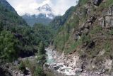 |
 Сагарматха Ущелье реки Дьон Коши. 03.05.1997. wet season |
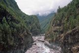 |
Сагарматха Хвойные леса в ущелье реки Дьон Коши перед подъемом к Намчи-Базар. 02.05.1997. wet season |
Plants and lichens
Participant
Search
| Feedback | Text to cite the page | To the top |