Челела / geographic pointLandscapes and habitats
online plant identification guide
Directories
Region
| Geographic point: | Челела |
| Coordinates: | 27° 22′ 24.07″ N, 89° 20′ 44.91″ E (view at maps of Google, OpenStreetMap, Yandex) |
| Administrative location: | Бутан, дзонгхаг Паро |
| Physiographic location: | Южная и Юго-Восточная Азия, Большие Гималаи, перевал Челела (Chelela Pass) |
| Author: | Вадим Должанский |
Description
Альпийские луга и заросли родендронов над поясом кедровых лесов
Images
From 1 to 4 are shown (4 of 4 found)
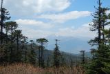 |
 Челела Хвойный лес на склонах Гималаев. 12.05.2019. spring |
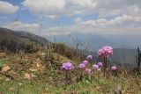 |
Челела Альпийские луга на высоте 3900 метров над уровнем моря. 12.05.2019. spring |
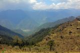 |
Челела Альпийские луга на высоте 3900 метров над уровнем моря. 12.05.2019. spring |
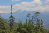 |
Челела Хвойный лес на склонах Гималаев. 12.05.2019. spring |
Plants and lichens
Participant
Search
| Feedback | Text to cite the page | To the top |