Тупакакурия / geographic pointLandscapes and habitats
online plant identification guide
Directories
Region
| Geographic point: | Тупакакурия |
| Coordinates: | 39° 09′ 55.02″ S, 175° 20′ 25.83″ E (view at maps of Google, OpenStreetMap, Yandex) |
| Administrative location: | Новая Зеландия, район Манавату-Уангануи, заповедник "Tupapakurua Falls" |
| Physiographic location: | Австралия и Океания, Новая Зеландия, Северный остров, бассейн реки Вангануи, бассейн реки Ретаруке • Австралия и Океания, Новая Зеландия, Северный остров, Вулканическое плато Северного острова |
| Author: | Вадим Должанский |
Description
Невысокие горные хребты, покрытые дождевыми лесами, на высоте 800-400 метров над уровнем моря.
Images
From 1 to 3 are shown (3 of 3 found)
 |
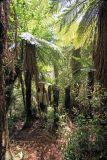
Тупакакурия Рощи древовидных папоротников. 21.12.2013. summer |
 |
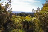
Тупакакурия Невысокие хребты в заповеднике "Тупакакурия Фолз". 21.12.2013. summer |
 |
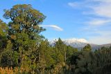
Тупакакурия Вид на вулкан Руапеху из заповедника "Тупакакурия Фолз". 21.12.2013. summer |
Text to cite the page
Должанский В.Ю. 2022. Тупакакурия [географическая точка: ландшафты и сообщества] // Плантариум. Растения и лишайники России и сопредельных стран: открытый онлайн атлас и определитель растений. [Электронный ресурс] URL: https://www.plantarium.ru/page/landscapes/point/11855.html (дата обращения: 02.02.2026).
Должанский В.Ю. 2022. Тупакакурия [geographic point: photos of landscapes and habitats] // Plantarium. Plants and lichens of Russia and neighboring countries: open online galleries and plant identification guide. URL: https://www.plantarium.ru/lang/en/page/landscapes/point/11855.html (accessed on 2 Feb 2026).
Plants and lichens
Participant
Search
|
|
Feedback | To the top |