Пик Вильгельм / geographic pointLandscapes and habitats
online plant identification guide
Directories
Region
| Geographic point: | Пик Вильгельм |
| Coordinates: | 5° 48′ 23.3″ S, 145° 04′ 43.89″ E (view at maps of Google, OpenStreetMap, Yandex) |
| Administrative location: | Папуа Новая Гвинея, регион Хайлендс, провинция Уэстерн-Хайлендс, окрестности лагеря "Camp JJ Komane mambuno" |
| Physiographic location: | Австралия и Океания, остров Новая Гвинея, хребет Бисмарка, пик Вильгельм |
| Author: | Вадим Должанский |
Description
Тропические горные облачные леса и мурленды выше 4000 метров над уровнем моря
Images
From 1 to 6 are shown (6 of 6 found)
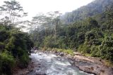 |
 Пик Вильгельм Горная река на хребте Бисмарка. 23.09.2009. end of dry season or early wet season |
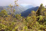 |
Пик Вильгельм Хребет Бисмарка покрыт тропическими лесами. 21.08.2009. end of dry season or early wet season |
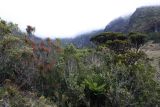 |
Пик Вильгельм Мурленды на склонах пика Вильгельм, высота 4200 метров над уровнем моря. 18.08.2009. end of dry season or early wet season |
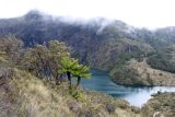 |
Пик Вильгельм Склоны пика Вильгельм покрыты злаками , кустарниками и древовидными папоротниками. 18.08.2009. end of dry season or early wet season |
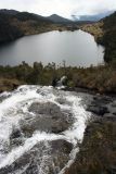 |
 Пик Вильгельм Вид со склонов пика Вильгельма на Camp JJ Komane mambuno, расположенный на дальнем краю озера. 18.08.2009. end of dry season or early wet season |
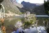 |
Пик Вильгельм Пик Вильгельма, вид от лагеря Camp JJ Komane mambuno. 18.08.2009. end of dry season or early wet season |
Text to cite the page
Должанский В.Ю. 2022. Пик Вильгельм [географическая точка: ландшафты и сообщества] // Плантариум. Растения и лишайники России и сопредельных стран: открытый онлайн атлас и определитель растений. [Электронный ресурс] URL: https://www.plantarium.ru/page/landscapes/point/11819.html (дата обращения: 08.10.2026).
Должанский В.Ю. 2022. Пик Вильгельм [geographic point: photos of landscapes and habitats] // Plantarium. Plants and lichens of Russia and neighboring countries: open online galleries and plant identification guide. URL: https://www.plantarium.ru/lang/en/page/landscapes/point/11819.html (accessed on 8 Oct 2026).
Plants and lichens
Participant
Search
|
|
Feedback | To the top |