Абу-Симбел / geographic pointLandscapes and habitats
online plant identification guide
Directories
Region
| Geographic point: | Абу-Симбел |
| Coordinates: | 22° 37′ 02.68″ N, 31° 34′ 50.86″ E (view at maps of Google, OpenStreetMap, Yandex) |
| Administrative location: | Египет, мухафаза Асуан, Нубийский район, город Абу-Симбел |
| Physiographic location: | Африка, Северная Африка, Сахара, бассейн реки Нил, бассейн водохранилища Насер |
| Author: | Вадим Должанский |
Description
Пустыня по берегам озера Насер (расширение Нила перед Асуанской плотиной)
Images
From 1 to 2 are shown (2 of 2 found)
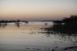 |
 Абу-Симбел Абу-Симбел, берег озера Насера. 19.03.2021. late winter or early spring |
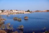 |
Абу-Симбел Абу-Симбел, 19.03.2021. late winter or early spring |
Plants and lichens
Participant
Search
|
|
Feedback | Text to cite the page | To the top |