Драконовы горы / geographic pointLandscapes and habitats
online plant identification guide
Directories
Region
| Geographic point: | Драконовы горы |
| Coordinates: | 29° 31′ 37.75″ S, 29° 21′ 33.68″ E (view at maps of Google, OpenStreetMap, Yandex) |
| Administrative location: | Южно-Африканская республика, Vergelegen Nature Reserve |
| Physiographic location: | Африка, Южная Африка, Южно-Африканское плоскогорье, Драконовы горы |
| Author: | Вадим Должанский |
Description
Отрог главного хребта между ручьями Kwantuba и Mkomazi. Альпийские луга на высотах 1600-2400 метров над уровнем моря.
Images
From 1 to 2 are shown (2 of 2 found)
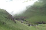 |
 Драконовы горы Вид на ручей с альпийских лугов на высоте 2300 м н.у.м. 05.01.2008. wet season |
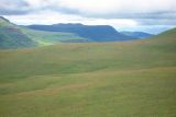 |
 Драконовы горы Альпийские луга на высоте около 1800 м н.у.м. 08.01.2008. wet season |
Plants and lichens
Participant
Search
|
|
Feedback | Text to cite the page | To the top |