Окрестности села Хнов / geographic pointLandscapes and habitats
online plant identification guide
Directories
Region
| Geographic point: | Окрестности села Хнов |
| Coordinates: | 41° 22′ 17.16″ N, 47° 27′ 36.97″ E (view at maps of Google, OpenStreetMap, Yandex) |
| Administrative location: | Россия, Республика Дагестан, Ахтынский район, окрестности села Хнов |
| Physiographic location: | Кавказ, Большой Кавказ, Восточный Кавказ, бассейн реки Самур, бассейн реки Ахтычай |
| Author: | Alexander Fateryga |
Images
From 1 to 2 are shown (2 of 2 found)
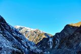 |
 Окрестности села Хнов Хновская долина, дорога в село Хнов. winter |
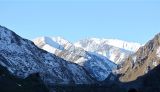 |
Окрестности села Хнов По реке Ахтычай долина Кизилдере. 13.11.2014. late autumn or early winter |
Plants and lichens
Participant
Search
| Feedback | Text to cite the page | To the top |