Озеро Теренкуль / geographic pointLandscapes and habitats
online plant identification guide
Directories
Region
| Geographic point: | Озеро Теренкуль |
| Coordinates: | 55° 01′ 00.65″ N, 60° 18′ 42.05″ E (view at maps of Google, OpenStreetMap, Yandex) |
| Administrative location: | Россия, Челябинская область, Чебаркульский район, окрестности города Чебаркуль |
| Physiographic location: | Урал, Южный Урал, озеро Теренкуль |
| Author: | Марина Скотникова |
Images
From 1 to 2 are shown (2 of 2 found)
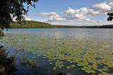 |
 Озеро Теренкуль Вид на оз. Теренкуль с северного берега. В воде растут Nuphar lutea, на берегу у воды - Alnus glutinosa, на противоположном берегу виден смешанный лес с преобладанием Pinus sylvestris. 07.08.2019. summer |
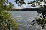 |
Озеро Теренкуль Вид на оз. Теренкуль с восточного берега. У воды растут Acer negundo и Alnus glutinosa, на противоположном берегу виден смешанный лес с преобладанием Pinus sylvestris. 07.08.2019. summer |
Plants and lichens
Participant
Search
| Feedback | Text to cite the page | To the top |