Покойное и его окрестности / geographic pointLandscapes and habitats
online plant identification guide
Directories
Region
| Geographic point: | Покойное и его окрестности |
| Coordinates: | 44° 48′ 44.65″ N, 44° 14′ 45.05″ E (view at maps of Google, OpenStreetMap, Yandex) |
| Administrative location: | Россия, Ставропольский край, Будённовский район, Покойненский сельсовет, село Покойное |
| Physiographic location: | Кавказ, Предкавказье, Среднее Предкавказье, долина реки Кума |
| Author: | Евгения Грищенко |
Images
Single image is found
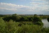 |
 Покойное и его окрестности Река Кума. На противоположном берегу заросли Tamarix ramosissima. 23.08.2009. summer |
Plants and lichens
Participant
Search
| Feedback | Text to cite the page | To the top |