Каоколенд / geographic pointLandscapes and habitats
online plant identification guide
Directories
Region
| Geographic point: | Каоколенд |
| Coordinates: | 18° 03′ 00″ S, 13° 50′ 00″ E (view at maps of Google, OpenStreetMap, Yandex) |
| Administrative location: | Намибия, область Кунене |
| Physiographic location: | Африка, Южная Африка, Южно-Африканское плоскогорье, плоскогорье Каоко |
| Author: | Светлана Евфратова |
Images
From 1 to 3 are shown (3 of 3 found)
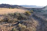 |
 Каоколенд Участок каменистой пустыни с сухим руслом. 21.01.2010. dry season |
 |
Каоколенд Окр. г. Опуво, Хижины племени Химба в саванне из Colophospermum mopane. 10.05.2019. late autumn or early winter |
 |
Каоколенд Саванна с Colophospermum mopane в окр. г. Опуво, 1300 м.н.у.м. 09.05.2019. late autumn or early winter |
Plants and lichens
Participant
Search
| Feedback | Text to cite the page | To the top |