Географические точки / forumОбсуждения географических точек (их границ, координат и прочих свойств)
online plant identification guide
Начать обсуждения можно через меню на страницах с пейзажами, снимками растений/лишайников и списками таксонов для географических точек.
| Topic | Last post | Replies Views | |
|---|---|---|---|
 | Topic started by Татьяна Журавлёва | new posts | 0 1943 |
 | Topic started by Dmitry Oreshkin | by Yuri Pirogov new posts | 3 2740 |
 | Topic started by Dmitry Oreshkin | new posts | 11 4298 |
 | Topic started by Dmitry Oreshkin | new posts | 0 1240 |
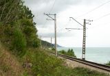 | Discussion of the geographic point Лазаревское Курортный посёлок Лазаревское с 1961 года входит в состав города-курорта Сочи в качестве районного центра. Посёлок удалён от цен... Point created by Vladimir Ivanov Topic started by Dmitry Oreshkin | new posts | 8 3507 |
 | Topic started by Dmitry Oreshkin Page: | new posts | 45 17026 |
 | Topic started by Yuri Pirogov | by Yuri Pirogov new posts | 0 2246 |
 | Discussion of the geographic point Окрестности пос. Светлый Среднетаёжные леса Центральной Якутии Point created by Галина Чуланова Topic started by Dmitry Oreshkin | by Yuri Pirogov new posts | 1 1844 |
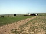 | Discussion of the geographic point Чу-Илийские горы, юг Чу-Илийские горы простираются с юго-востока на северо-запад на 220 км до западного окончания озера Балхаш, их наибольшая высота ... Point created by Игорь Стяжкин Topic started by Dmitry Oreshkin | new posts | 0 1276 |
 | Topic started by Dmitry Oreshkin | by Ира Хан new posts | 1 2634 |
 | Discussion of the geographic point Алёшино Долина реки Вычегды с многочисленными старицами, заливными лугами и увалами, поросшими лесом. Point created by Лида Онищенко Topic started by Dmitry Oreshkin | new posts | 4 2409 |
 | Discussion of the geographic point Маджа Болото, лес, старый песчаный карьер вдоль дороги к поселку Маджа Point created by Лида Онищенко Topic started by Dmitry Oreshkin | new posts | 1 2139 |
 | Topic started by Dmitry Oreshkin | new posts | 12 7126 |
 | Discussion of the geographic point Горы Согети Северо-восточный отрог Заилийского Алатау, на юге переходящий в хребет Бокайдынтау, на севере - в горы Балабогуты (Балабогетты) ... Point created by Игорь Стяжкин Topic started by Игорь Стяжкин | new posts | 11 7934 |
 | Topic started by Анатолий Лисицын | new posts | 3 2367 |
 | Topic started by Dmitry Oreshkin | new posts | 4 2136 |
 | Discussion of the geographic point Село Языково Склон остепнённого холма, тянущегося до реки Сура Point created by Sergey Appolonov Topic started by Sergey Appolonov | new posts | 4 2458 |
 | Topic started by Dmitry Oreshkin | new posts | 5 2537 |
 | Discussion of the geographic point Зимовка Таскора L-40-V справка о местности Рельеф представляет собой всхолмленную равнину. Холмистая равнина характерна чередованием плоскове... Point created by Виталий Недосейкин Topic started by Nikolay Degtyaryov Page: | new posts | 46 30287 |
| Topic started by Aleksandr Ebel | new posts | 9 4136 |
 | Topic started by Vladislav Grigorenko Page: | new posts | 100 25448 |
 | Discussion of the geographic point Туюкская долина Высокогорные альпийские болота с бугристым крупнокочковым рельефом, чередующиеся с альпийскими лугами, ерниками и участками куру... Point created by Gleb Kamalutdinov Topic started by Dmitry Oreshkin Page: | new posts | 58 19173 |
 | Discussion of the geographic point Ундугун Озёра Большой и Малый Ундугун проточные, расположены в западной части котловины, занятой Иван-Арахлейской системой озёр. Травяно... Point created by Vladimir Ivanov Topic started by Nikolay Degtyaryov | new posts | 19 8323 |
 | Discussion of the geographic point Левый берег Камы Правый песчаный берег Камы напротив д. Поварёнки с многочисленными старицами. Point created by Sergey Appolonov Topic started by Sergey Appolonov | new posts | 0 1487 |
 | Discussion of the geographic point Бабуган Самый высокий массив Главной Крымской гряды, севернее и северо-западнее Гурзуфа и Алушты. Средняя высота плато 1000–1400 м. Слож... Point created by Pavel Yevseyenkov Topic started by Dmitry Oreshkin | new posts | 5 3805 |
| Feedback | To the top | |