Географические точки / forumОбсуждения географических точек (их границ, координат и прочих свойств)
online plant identification guide
Начать обсуждения можно через меню на страницах с пейзажами, снимками растений/лишайников и списками таксонов для географических точек.
| Topic | Last post | Replies Views | |
|---|---|---|---|
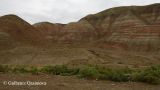
 | Discussion of the geographic point Тархатинские мегалиты Это урочище известно больше как Тархатинский мегалитический комплекс. Но такое длинное название не помещается в название географ... Point created by Александр Лебедев Topic started by Dmitry Oreshkin | new posts | 5 807 |
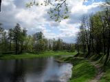
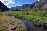
 | Discussion of the geographic point Долина р. Чёрная Моховые ельники вдоль реки, луга, сенокосы и лиственничники. Point created by Gleb Kamalutdinov Topic started by Dmitry Oreshkin | new posts | 0 380 |
 | Topic started by Александр Лебедев | new posts | 0 547 |
 | Topic started by Александр Лебедев | new posts | 1 594 |
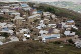
| Discussion of the geographic point Город Ломоносов Жилые кварталы, пустыри, леса и лесопарки, окрестности железнодорожных платформ и путей, водоёмы и их окрестности Point created by Андрей Белехов Topic started by Mariia Novikova | new posts | 0 533 |
| Topic started by Александр Лебедев | new posts | 0 451 |
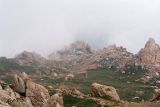
 | Discussion of the geographic point Согети Северные предгорья хребта Согети (Сюгаты) Point created by Yuri Pirogov Topic started by Vladimir Kolbintsev | new posts | 3 787 |
 | Topic started by Mariia Novikova | new posts | 3 625 |
 | Topic started by Александр Лебедев | new posts | 2 606 |
 | Topic started by Dmitry Oreshkin | new posts | 2 742 |
 | Discussion of the geographic point Вергунский Разъезд Местность расположена на северо-восточной окраине г. Луганска, на пологом приводораздельном склоне долины Северский Донец. Вклю... Point created by Tatjana Sova Topic started by Dmitry Oreshkin | by Tatjana Sova new posts | 1 965 |
 | Topic started by Dmitry Oreshkin | new posts | 0 421 |
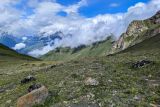
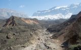
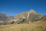 | Discussion of the geographic point Перевал Шузулгу Перевал Шузулгу (н/к, 2029 м) соединяет долины рек Кардан и Шузулгу, правых притоков реки Чегем. Находится в седловине между г. ... Point created by Ilia Mikheev Topic started by Dmitry Oreshkin | new posts | 2 672 |
| Topic started by Dmitry Oreshkin | new posts | 1 1686 |
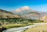
| Discussion of the geographic point г. Кисловодск Кисловодск — город, административный центр муниципального образования «Городской округ Город-курорт Кисловодск» Ставропольского ... Point created by Эдуард Гарин Topic started by Dmitry Oreshkin | new posts | 5 2460 |
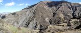
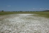 | Discussion of the geographic point Кодунский солонец Солонец в сухое время года покрытый слоем солевых кристаллов, во время дождей образует мелкое озеро. Point created by Наталья Гагаринова Topic started by Dmitry Oreshkin | new posts | 0 454 |
| Topic started by Yuliya Borisova | new posts | 3 575 |
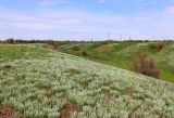
| Discussion of the geographic point Железная дорога в Крупском Железнодорожная насыпь, окружённая кустарниками и покрыя сухим низкотравным лугом. Представлены редкие для области степные виды. Point created by Вадим Рыбаков Topic started by Mariia Novikova | new posts | 1 551 |
 | Topic started by Alexander Fateryga | new posts | 0 516 |
 | Topic started by Alexander Fateryga | new posts | 1 408 |
 | Topic started by Alexander Fateryga | new posts | 1 488 |
 | Topic started by Alexander Fateryga | new posts | 1 622 |
 | Topic started by Alexander Fateryga | new posts | 1 422 |
 | Topic started by Alexander Fateryga | new posts | 1 489 |
 | Topic started by Alexander Fateryga | new posts | 1 482 |
|
|
Feedback | To the top |