Средняя Ахтуба / geographic pointPhotos of plants and lichens
online plant identification guide
Directories
Region
| Geographic point: | Средняя Ахтуба |
| Coordinates: | 48° 43′ 25″ N, 44° 52′ 13″ E (view at maps of Google, OpenStreetMap, Yandex) |
| Administrative location: | Россия, Волгоградская область, Среднеахтубинский район, окрестности рабочего посёлка Средняя Ахтуба;Россия, Волгоградская область, Среднеахтубинский район, рабочий посёлок Средняя Ахтуба |
| Physiographic location: | Восточно-Европейская равнина, бассейн реки Волга, бассейн реки Ахтуба, долина реки Ахтуба;Восточно-Европейская равнина, Прикаспийская низменность;Восточно-Европейская равнина, Прикаспийская низменность, Волго-Ахтубинская пойма |
| Author: | Yuliya Borisova |
| Description: | show |
| Links to web resources: | show |
Images
The author of the photos shown here is Evgeny Komarov. These photos are just a part of the complete set of images.
Single image is found
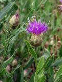 |
 Соцветие. Волгоградская обл., Среднеахтубинский р-н. Май 2003 г. |
Text to cite the page
Борисова Ю., Комаров Е. 2017. Средняя Ахтуба [географическая точка: фотографии растений и лишайников] // Плантариум. Растения и лишайники России и сопредельных стран: открытый онлайн атлас и определитель растений. [Электронный ресурс] URL: https://www.plantarium.ru/page/dwellers/point/9591.html (дата обращения: 17.09.2026).
Borisova Y., Komarov E. 2017. Средняя Ахтуба [geographic point: photos of plants and lichens] // Plantarium. Plants and lichens of Russia and neighboring countries: open online galleries and plant identification guide. URL: https://www.plantarium.ru/lang/en/page/dwellers/point/9591.html (accessed on 17 Sep 2026).
Plants and lichens
Participant
Search
|
|
Feedback | To the top |