Долина реки Шураозень / geographic pointLandscapes and habitats
online plant identification guide
Directories
Region
| Geographic point: | Долина реки Шураозень |
| Coordinates: | 42° 58′ 42.89″ N, 47° 11′ 43.94″ E (view at maps of Google, OpenStreetMap, Yandex) |
| Administrative location: | Россия, Республика Дагестан, Кумторкалинский район |
| Physiographic location: | Кавказ, Большой Кавказ, Восточный Кавказ, бассейн реки Шураозень, долина реки Шураозень |
| Author: | Gennadiy Okatov |
Images
The author of the photos shown here is Марина Скотникова. These photos are just a part of the complete set of images.
From 1 to 4 are shown (4 of 4 found)
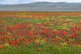 |
 Долина реки Шураозень Луг с аспектом цветущих Papaver и Senecio vernalis, также видны Carduus uncinatus и Hordeum. 30.04.2022. spring |
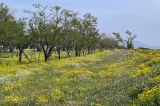 |
Долина реки Шураозень Окраина луга с цветущими Senecio vernalis, Carduus uncinatus и Papaver. Слева видны придорожные посадки Ulmus pumila. 30.04.2022. spring |
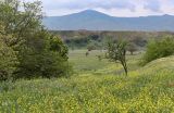 |
Долина реки Шураозень Пойменный луг с аспектом цветущих Sisymbrium в долине р. Шураозень. 30.04.2022. spring |
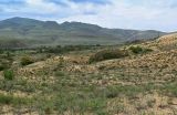 |
Долина реки Шураозень Вид на долину р. Шураозень с поросшего Euphorbia, Calligonum, Astragalus и Artemisia склона бархана Сарыкум. 30.04.2022. spring |
Plants and lichens
Participant
Search
|
|
Feedback | Text to cite the page | To the top |