Озеро Дунд-Нуур / geographic pointLandscapes and habitats
online plant identification guide
Directories
Region
| Geographic point: | Озеро Дунд-Нуур |
| Coordinates: | 49° 29′ 25.18″ N, 89° 48′ 28.34″ E (view at maps of Google, OpenStreetMap, Yandex) |
| Administrative location: | Монголия, аймак Баян-Улгий, сомон Цагааннуур |
| Physiographic location: | Горы Южной Сибири, Алтай, Монгольский Алтай, озеро Дунд-Нуур |
| Author: | Марина Скотникова |
Images
The author of the photos shown here is Александр Лебедев. These photos are just a part of the complete set of images.
From 1 to 4 are shown (4 of 4 found)
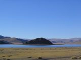 |
 Озеро Дунд-Нуур Окрестности озера с севера. 24.09.2005. autumn |
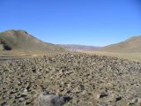 |
Озеро Дунд-Нуур Окрестности озера с севера. 24.09.2005. autumn |
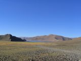 |
Озеро Дунд-Нуур Окрестности озера с севера. 24.09.2005. autumn |
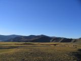 |
Озеро Дунд-Нуур Окрестности озера с севера. 24.09.2005. autumn |
Plants and lichens
Participant
Search
| Feedback | Text to cite the page | To the top |