Салехард / geographic pointLandscapes and habitats
online plant identification guide
Directories
Region
| Geographic point: | Салехард |
| Coordinates: | 66° 32′ 41.02″ N, 66° 36′ 03.5″ E (view at maps of Google, OpenStreetMap, Yandex) |
| Administrative location: | Россия, Ямало-Ненецкий Автономный Округ, Приуральский район, город Салехард |
| Physiographic location: | Западно-Сибирская равнина, бассейн реки Обь, долина реки Обь |
| Author: | Maria Kozlova |
Images
The author of the photos shown here is Aleksei Titov. These photos are just a part of the complete set of images.
From 1 to 3 are shown (3 of 3 found)
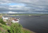 |
 Салехард Река Полуй перед впадением в р. Обь. На переднем плане зеленеют ивы (Salix), в нижнем левом углу цветет иван-чай (Chamaenerion). Август 2010 г. late summer or early autumn |
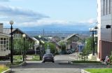 |
Салехард Вид из Салехарда на р. Обь, г. Лабытнанги и виднеющийся вдали Полярный Урал. Справа около здания молодые лиственницы (Larix) Август 2010 г. late summer or early autumn |
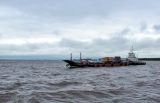 |
Салехард Река Обь между Салехардом и Лабытнанги. Август 2010 г. late summer or early autumn |
Plants and lichens
Participant
Search
|
|
Feedback | Text to cite the page | To the top |