Город Йошкар-Ола / geographic pointPhotos of plants and lichens
online plant identification guide
Directories
Region
| Geographic point: | Город Йошкар-Ола |
| Coordinates: | 56° 37′ 58″ N, 47° 53′ 23″ E (view at maps of Google, OpenStreetMap, Yandex) |
| Administrative location: | Россия, Республика Марий Эл, город Йошкар-Ола |
| Physiographic location: | Восточно-Европейская равнина, Марийская низменность |
| Author: | Елена Иванова |
| Description: | show |
Images
The author of the photos shown here is Светлана Нестерова. These photos are just a part of the complete set of images.
Single image is found
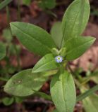 |
 Верхушка побега в начале цветения. Республика Марий-Эл, г. Йошкар-Ола, сорное на газоне. 22.05.2017. |
Plants and lichens
Participant
Search
|
|
Feedback | Text to cite the page | To the top |