Мангуп-Кале / geographic pointPhotos of plants and lichens
online plant identification guide
Directories
Region
| Geographic point: | Мангуп-Кале |
| Coordinates: | 44° 35′ 45″ N, 33° 48′ 07″ E (view at maps of Google, OpenStreetMap, Yandex) |
| Administrative location: | Россия, Республика Крым, Бахчисарайский район, Красномакское сельское поселение, окрестности села Ходжа-Сала |
| Physiographic location: | Средиземноморье и Переднеазиатские нагорья, Горный Крым, Крымское предгорье, Внутренняя гряда, гора Баба-Даг (Мангуп) |
| Author: | Sergey Bulanov |
| Description: | show |
Images
The author of the photos shown here is Михаил Лучкин. These photos are just a part of the complete set of images.
Single image is found
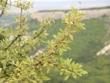 |
 Ветви с плодами. Крым, Бахчисарайский р-н, пещерный город. 15 августа 2019 г. |
Plants and lichens
Participant
Search
| Feedback | Text to cite the page | To the top |