Каньон Машат / geographic pointPhotos of plants and lichens
online plant identification guide
Directories
Region
| Geographic point: | Каньон Машат |
| Coordinates: | 42° 25′ 30″ N, 70° 03′ 00″ E (view at maps of Google, OpenStreetMap, Yandex) |
| Administrative location: | Казахстан, Туркестанская область, Тюлькубасский район, Сайрам-Угамский национальный парк, Тюлькубасский филиал |
| Physiographic location: | Средняя Азия и Центральный Казахстан, Горы Средней Азии и Казахстана, Тянь-Шань, Западный Тянь-Шань, каньон реки Машат |
| Author: | Vladimir Kolbintsev |
| Description: | show |
Images
The author of the photos shown here is Lina Valdshmit. These photos are just a part of the complete set of images.
From 1 to 2 are shown (2 of 2 found)
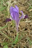 |
 Цветущее растение. Южный Казахстан, перевал Машат. 8.03.2009. |
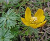 |
Цветущее растение. Южный Казахстан, перевал Машат. 7.03.2009. |
Plants and lichens
Participant
Search
| Feedback | Text to cite the page | To the top |