Варнутская долина / geographic point
Photos of plants and lichens

Plantarium
online plant identification guide

Region

Geographic point:Варнутская долина
Coordinates:44° 28′ 10″ N, 33° 40′ 25″ E (view at maps of Google, OpenStreetMap, Yandex)
Administrative location:Россия, город Севастополь, Балаклавский район, Орлиновский муниципальный округ
Physiographic location:Средиземноморье и Переднеазиатские нагорья, Горный Крым, Главная гряда, Варнутская долина
Author:Pavel Yevseyenkov
Description:show

Images

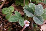
Potentilla micrantha. Цветущее растение. Крым, окр. с. Резервное. 30 марта 2009 г.
Цветущее растение. Крым, окр. с. Резервное. 30 марта 2009 г.
Pavel Yevseyenkov

Text to cite the page

Евсеенков П., Пирогов Ю.К., Саплицкая Л., Фатерыга А. 2012—2013. Варнутская долина [географическая точка: фотографии растений и лишайников] // Плантариум. Растения и лишайники России и сопредельных стран: открытый онлайн атлас и определитель растений. [Электронный ресурс] URL: https://www.plantarium.ru/page/dwellers/point/1715.html (дата обращения: 28.08.2026).
Yevseyenkov P., Pirogov Y., Саплицкая Л., Fateryga A. 2012—2013. Варнутская долина [geographic point: photos of plants and lichens] // Plantarium. Plants and lichens of Russia and neighboring countries: open online galleries and plant identification guide. URL: https://www.plantarium.ru/lang/en/page/dwellers/point/1715.html (accessed on 28 Aug 2026).
For mobile devices
Search
Top.Mail.Ru Feedback To the top
www.plantarium.ru
"Plantarium" uses cookies. By continuing to browse the site, you consent to their use.